


Google Maps has partnered with Thomas Pesquet, a European astronaut, to create the first Street View image captured from space, aboard the International Space Station (ISS).
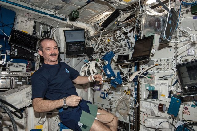
People everywhere can view the inside of the International Space Station at a 360-degree panoramic view. ISS is a spacecraft that orbits the earth at more than 17,500 miles per hour.
In a blog post Pesquet wrote, “It was difficult to find the words or to take a picture that accurately describes the feeling of being in space.”
Google representatives hope to inspire the public to further explore space and other areas.
There will be detailed descriptions of the objects aboard the International Station to help people understand what they are viewing. For example, tiny dots will be placed near objects and when clicked, will explain the specific functions it may perform. There are also descriptions for spacesuits, solar energy, and the actions of the vacuums in space.
The International Space Station will show areas where the astronauts eat, sleep, exercise, and work. The panoramic views were made by “stitching together” pictures taken by DLSR cameras.
Project Manager Alice Liu stated, “The astronauts had to take the pictures at the defined angles and float around the camera to complete a set of images. It took up to 24 images to create a single panorama.”
Pesquet stated, “There are a lot of obstacles up there, and we had limited time to capture the imagery, oh, there’s that zero gravity thing.”
In past efforts, Google has tried to capture imagery such as Australia’s Great Barrier Reef and Machu Picchu. At that time, the costs for this certification process was not close to practical.
Ben Wood from the CCS tech consultancy said, “This feels like a cute marketing exercise that will keep Maps and Street View front and centre in consumers’ minds.” He added, “It adds a dimension of fun and one could argue also education, as it’s a tool you can see schools adopting if they are doing projects in space.”
Google also worked with NASA and the Marshall Space Flight Center to come up with the method to collect the images aboard the International Space Station using DLSR cameras.
Matthew Potter, Google’s technical operation lead for Street View stated, “The tech giant reached for the stars because Earth was no longer big enough. We have mapped all over the world and really wanted to see where we could go.”
This operation aboard the International Space Station took around four months to complete. The project involved six crew members and 12 hours a day of research and maintenance activities.
This milestone comes 48 years after the first man landed on the moon.
Written by Nicole Thompson
Edited by Jeanette Smith
Sources:
The National: International Space Station helps Google map the Heavens
Newsweek: Tour the International Space Station with Google Street View
BBC: Google Maps adds International Space Station
Washington Post: Google Street-view’s latest destination, The International Space Station
Featured and Top Image Courtesy of NASA’s Marshall Space Flight Center’s Flickr Page – Creative Commons License